Gardening in Hawaii: Hardiness Zones, Frost Dates & What Grows
Hawaii is the warm end of the whole map: zones 10b to 13a, with 71% of ZIP codes in 12b and about 61% frost-free in a typical year. Here the zone is an altitude dial more than a latitude one. Sea-level neighborhoods are zones 12 and 13; climbing the volcanoes walks you down through 11 to 10b, where the high country around Captain Cook has the state's shortest season at 235 days, still longer than the best season in most of the mainland.
Trade winds keep even the warm zones gentler than a mainland summer at the same zone number, and rain, wind, and sun exposure vary more across a few miles than temperature does. The table below is still worth reading closely: it is the only state table where most rows honestly say there is no typical freeze.
Hawaii at a glance
| Hardiness zones | 10b to 13a, coldest to warmest ZIP code |
|---|---|
| Most common zone | 12b, covering 71% of the state's ZIP codes |
| ZIP codes covered | 133 |
| Changed in the 2023 map update | 23% of ZIP codes sit in a different half zone than on the 2012 map |
| Freezes | No typical freeze over most of the state; see the freeze section below |
| Frost-free season | Typical 365 days; across the state it runs from 235 to 365 days |
| ZIP codes frost-free in a typical year | 61% |
| Winter chill, estimated | 0 to 2,362 hours below 45 °F, depending on the ZIP code |
| Weather stations behind the numbers | 2 NOAA stations serve the state's ZIP codes |
| Member yards with photos on YardShare | 1 |
How the zones spread across Hawaii
Each row is one half zone found in the state, with the winter cold it stands for and the share of the state's ZIP codes in it. The zone guide for each row goes deeper: what grows there, when freezes come, and real yards in that zone.
| Half zone | Coldest night in a typical winter | Share of ZIP codes | ZIP codes | Zone guide |
|---|---|---|---|---|
| 10b | 35 to 40 °F | 1% | 1 | Zone 10 guide |
| 11a | 40 to 45 °F | 6% | 8 | Zone 11 guide |
| 11b | 45 to 50 °F | 2% | 3 | Zone 11 guide |
| 12a | 50 to 55 °F | 18% | 24 | Zone 12 guide |
| 12b | 55 to 60 °F | 71% | 95 | Zone 12 guide |
| 13a | 60 to 65 °F | 2% | 2 | No separate guide; see the text below |
Freeze dates and the growing season
Freeze dates barely apply in Hawaii. Only the high-elevation ZIP codes ever see frost, so there is no statewide typical freeze date worth printing: where frost occurs, it is a still, clear winter night at altitude, not a season boundary. The extremes below come from the minority of ZIP codes with real freeze seasons. Gardeners here plan around rain, wind, and sun far more than cold.
- Earliest last spring freeze: Captain Cook (ZIP 96704), around Apr 12.
- Latest last spring freeze: Captain Cook (ZIP 96704), around Apr 12.
- Earliest first fall freeze: Captain Cook (ZIP 96704), around Dec 1.
- Latest first fall freeze: Captain Cook (ZIP 96704), around Dec 1.
- Shortest frost-free season: Captain Cook (ZIP 96704), 235 days.
- Longest frost-free season: Aiea (ZIP 96701), 365 days.
These dates are medians from 30 years of records, so in any single year your last freeze can land a week or two on either side. The ZIP code lookup also shows the cautious dates for your ZIP (the dates only about 1 year in 10 beats), and the seed starting calculator turns your ZIP's dates into a planting calendar.
The biggest places, and their numbers
The state's largest cities by population, each shown with the zone and freeze dates of its largest ZIP code. A big city can span several zones on the ground, so plant by your own ZIP's row in the table below, not by the city's.
| City | Zone | Last spring freeze | First fall freeze | Frost-free season |
|---|---|---|---|---|
| Honolulu | 12b | No typical freeze | No typical freeze | Year-round |
| Waipahu | 12a | No typical freeze | No typical freeze | Year-round |
| Ewa Beach | 12b | No typical freeze | No typical freeze | Year-round |
| Kaneohe | 12b | No typical freeze | No typical freeze | Year-round |
| Mililani | 12a | No typical freeze | No typical freeze | Year-round |
| Kailua | 12b | No typical freeze | No typical freeze | Year-round |
| Waianae | 12b | No typical freeze | No typical freeze | Year-round |
| Hilo | 11a | Apr 12 | Dec 1 | 235 days |
| Wahiawa | 12a | No typical freeze | No typical freeze | Year-round |
| Pearl City | 12a | No typical freeze | No typical freeze | Year-round |
What grows well in Hawaii
At sea level the planting is fully tropical: palms, mango, avocado, and banana from the warm-zone palettes, cooling with altitude into a wide subtropical range. Winter chill is essentially zero at sea level (the median ZIP gets 0 hours below 45 °F) and rises to about 2,362 hours only at the highest stations, so temperate fruit trees are a high-altitude specialty, not a lowland one. Salt wind near the shore and storm-season wind are the structural challenges: check trees ahead of hurricane season and favor wind-resistant plantings.
By zone, the proven highlights from our extension-sourced plant palettes:
| Zone 10 | Royal palm, lignum vitae, and wild tamarind, with mango and avocado in home landscapes |
|---|---|
| Zone 11 | Gumbo limbo, sea grape, buttonwood, and pitch apple, and mango, avocado, banana, and papaya turn reliable |
| Zone 12 | Kamani, hau, hala, and coconut on the exposed coast, with royal poinciana, mango, and plumeria in protected spots |
Real yards in Hawaii
Real member yards from the archive, 1 with photos across the state:
-
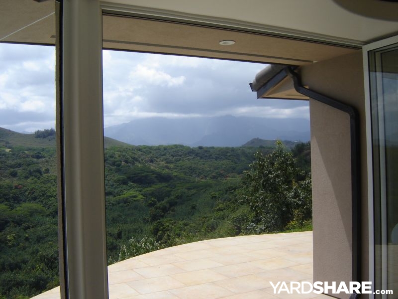 5 photos Zone 12
Paradise Found
We bought this house "on the cliff" to remodel and sell, but after a cosmetic remodel, then a complete...
Looking for ideas rather than climate data? Browse real Hawaii yards, filterable by feature, size, and style.
Hawaii ZIP codes with 10,000 or more residents
The listing behind this page, capped where most of the state actually lives: 35 of Hawaii's 133 ZIP codes have 10,000 or more residents. Each row carries its 2023 and 2012 zones, the median last spring and first fall freeze dates at 32 °F, and the frost-free season between them. Every figure above is computed from all 133 ZIP codes, including the smaller ones not listed here; if your ZIP code is not in the table, the ZIP code lookup has its exact dates. Start typing a ZIP code or a town name to filter the list.
| ZIP | Town | Zone 2023 | Zone 2012 | Last spring freeze | First fall freeze | Frost-free days |
|---|---|---|---|---|---|---|
| 96701 | Aiea | 12a | 12b | No typical freeze | No typical freeze | 365 |
| 96706 | Ewa Beach | 12b | 12b | No typical freeze | No typical freeze | 365 |
| 96707 | Kapolei | 12b | 12b | No typical freeze | No typical freeze | 365 |
| 96708 | Haiku | 12a | 12b | Apr 12 | Dec 1 | 235 |
| 96720 | Hilo | 11a | 12b | Apr 12 | Dec 1 | 235 |
| 96732 | Kahului | 12b | 12b | Apr 12 | Dec 1 | 235 |
| 96734 | Kailua | 12b | 12b | No typical freeze | No typical freeze | 365 |
| 96740 | Kailua Kona | 12b | 12b | Apr 12 | Dec 1 | 235 |
| 96743 | Kamuela | 11a | 11a | Apr 12 | Dec 1 | 235 |
| 96744 | Kaneohe | 12b | 12b | No typical freeze | No typical freeze | 365 |
| 96746 | Kapaa | 12a | 12a | No typical freeze | No typical freeze | 365 |
| 96749 | Keaau | 12b | 12b | Apr 12 | Dec 1 | 235 |
| 96753 | Kihei | 12b | 12b | Apr 12 | Dec 1 | 235 |
| 96761 | Lahaina | 12b | 12b | Apr 12 | Dec 1 | 235 |
| 96766 | Lihue | 12a | 12a | No typical freeze | No typical freeze | 365 |
| 96768 | Makawao | 12a | 12a | Apr 12 | Dec 1 | 235 |
| 96778 | Pahoa | 12b | 12a | Apr 12 | Dec 1 | 235 |
| 96782 | Pearl City | 12a | 12a | No typical freeze | No typical freeze | 365 |
| 96786 | Wahiawa | 12a | 12a | No typical freeze | No typical freeze | 365 |
| 96789 | Mililani | 12a | 12a | No typical freeze | No typical freeze | 365 |
| 96792 | Waianae | 12b | 12b | No typical freeze | No typical freeze | 365 |
| 96793 | Wailuku | 12b | 12b | Apr 12 | Dec 1 | 235 |
| 96795 | Waimanalo | 12b | 12b | No typical freeze | No typical freeze | 365 |
| 96797 | Waipahu | 12a | 12a | No typical freeze | No typical freeze | 365 |
| 96813 | Honolulu | 12b | 12b | No typical freeze | No typical freeze | 365 |
| 96814 | Honolulu | 12b | 12b | No typical freeze | No typical freeze | 365 |
| 96815 | Honolulu | 12b | 12b | No typical freeze | No typical freeze | 365 |
| 96816 | Honolulu | 12b | 12b | No typical freeze | No typical freeze | 365 |
| 96817 | Honolulu | 12b | 12b | No typical freeze | No typical freeze | 365 |
| 96818 | Honolulu | 12b | 12b | No typical freeze | No typical freeze | 365 |
| 96819 | Honolulu | 12b | 12b | No typical freeze | No typical freeze | 365 |
| 96821 | Honolulu | 12b | 12b | No typical freeze | No typical freeze | 365 |
| 96822 | Honolulu | 12b | 12a | No typical freeze | No typical freeze | 365 |
| 96825 | Honolulu | 12b | 12b | No typical freeze | No typical freeze | 365 |
| 96826 | Honolulu | 12b | 12b | No typical freeze | No typical freeze | 365 |
Plan your Hawaii garden
- Look up your zone by ZIP code, with the cautious freeze dates for your exact spot.
- Seed starting calculator: turn your ZIP's freeze dates into sowing and transplant dates.
- Chill hours estimator: check a fruit tree's winter chill needs against your ZIP before you plant it.
- Compare two zones side by side, handy if you garden in two parts of the state.
- All state guides: every state and DC, side by side.
Sources and method: zones from the 2023 USDA Plant Hardiness Zone Map per-ZIP listing (USDA and PRISM Climate Group, Oregon State University; 1991 to 2020 normals), with the 2012 listing behind the change figures. Freeze dates and season lengths are medians from NOAA NCEI 1991 to 2020 U.S. Climate Normals for the weather station serving each ZIP; 133 of the state's 133 ZIP codes have a station close enough to carry freeze data. Chill figures are estimates computed from the same NOAA monthly normals and are labeled as estimates wherever they appear. Town names and populations come from the site's ZIP code table. Plant highlights are from the YardShare zone plant palettes, drawn from university extension publications. A ZIP code can cross a zone boundary on the ground; the listing gives one zone for the ZIP as a whole.