Gardening in District of Columbia: Hardiness Zones, Frost Dates & What Grows
The District is a city-sized climate: 86% of its ZIP codes are zone 8a, the rest are 7b, and every single ZIP code changed in the 2023 map update, the only clean sweep in the country. The typical last freeze is Mar 29, the first fall freeze is Nov 8, and the season runs from 202 to 241 days depending on the neighborhood.
The warmest ZIP codes sit along the Potomac and in the built-up core. Buildings, pavement, and the river do for the District what an ocean does for a coast: they take the edge off winter nights. A courtyard garden downtown and an open yard in the District's higher northwest are effectively in different zones, and the table below shows the difference ZIP by ZIP.
District of Columbia at a glance
| Hardiness zones | 7b to 8a, coldest to warmest ZIP code |
|---|---|
| Most common zone | 8a, covering 86% of the state's ZIP codes |
| ZIP codes covered | 275 |
| Changed in the 2023 map update | 100% of ZIP codes sit in a different half zone than on the 2012 map |
| Typical last spring freeze (32 °F) | Mar 29 |
| Typical first fall freeze (32 °F) | Nov 8 |
| Frost-free season | Typical 224 days; across the state it runs from 202 to 241 days |
| Winter chill, estimated | 2,226 to 2,601 hours below 45 °F, depending on the ZIP code |
| Weather stations behind the numbers | 3 NOAA stations serve the state's ZIP codes |
| Member yards with photos on YardShare | 2 |
How the zones spread across District of Columbia
Each row is one half zone found in the state, with the winter cold it stands for and the share of the state's ZIP codes in it. The zone guide for each row goes deeper: what grows there, when freezes come, and real yards in that zone.
| Half zone | Coldest night in a typical winter | Share of ZIP codes | ZIP codes | Zone guide |
|---|---|---|---|---|
| 7b | 5 to 10 °F | 14% | 39 | Zone 7 guide |
| 8a | 10 to 15 °F | 86% | 236 | Zone 8 guide |
Freeze dates and the growing season
Across District of Columbia, the middle ZIP code that freezes sees its last 32 °F spring freeze around Mar 29 and its first fall freeze around Nov 8, which makes a typical frost-free season of 224 days. Treat those as the state's middle, not your garden's dates. The spread inside the state is the real story:
- Earliest last spring freeze: Washington (ZIP 20006), around Mar 24.
- Latest last spring freeze: Washington (ZIP 20007), around Apr 9.
- Earliest first fall freeze: Washington (ZIP 20007), around Oct 31.
- Latest first fall freeze: Washington (ZIP 20006), around Nov 18.
- Shortest frost-free season: Washington (ZIP 20007), 202 days.
- Longest frost-free season: Washington (ZIP 20006), 241 days.
These dates are medians from 30 years of records, so in any single year your last freeze can land a week or two on either side. The ZIP code lookup also shows the cautious dates for your ZIP (the dates only about 1 year in 10 beats), and the seed starting calculator turns your ZIP's dates into a planting calendar.
The biggest places, and their numbers
The state's largest cities by population, each shown with the zone and freeze dates of its largest ZIP code. A big city can span several zones on the ground, so plant by your own ZIP's row in the table below, not by the city's.
| City | Zone | Last spring freeze | First fall freeze | Frost-free season |
|---|---|---|---|---|
| Washington | 7b | Mar 29 | Nov 8 | 224 days |
| Naval Anacost Annex | 8a | Mar 24 | Nov 18 | 241 days |
| Washington Navy Yard | 8a | Mar 24 | Nov 18 | 241 days |
| Parcel Return Service | 8a | No typical freeze | No typical freeze | Year-round |
What grows well in District of Columbia
The full Mid-Atlantic palette grows here, plus a half-zone bonus in sheltered courtyards and against south-facing walls: crape myrtles, southern magnolia, and camellias in protected spots are all reasonable bets. The city's real gardening constraint is summer, when heat reflecting off pavement bakes containers and rooftops; shade and steady water matter more than winter protection. Winter chill (2,226 to 2,601 hours) covers peaches and most apples for anyone with room for a small tree.
By zone, the proven highlights from our extension-sourced plant palettes:
| Zone 7 | Eastern redbud, Shumard oak, crape myrtle, and southern magnolia; the Piedmont spring garden |
|---|---|
| Zone 8 | Live oak, southern magnolia, laurel oak, and crape myrtle, with azaleas and camellias underneath in the South |
Real yards in District of Columbia
Real member yards from the archive, 2 with photos across the state:
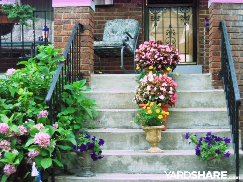
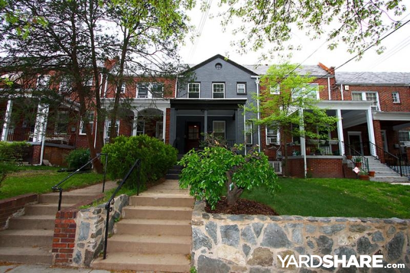
Looking for ideas rather than climate data? Browse real District of Columbia yards, filterable by feature, size, and style.
District of Columbia ZIP codes with 10,000 or more residents
The listing behind this page, capped where most of the state actually lives: 19 of District of Columbia's 275 ZIP codes have 10,000 or more residents. Each row carries its 2023 and 2012 zones, the median last spring and first fall freeze dates at 32 °F, and the frost-free season between them. Every figure above is computed from all 275 ZIP codes, including the smaller ones not listed here; if your ZIP code is not in the table, the ZIP code lookup has its exact dates. Start typing a ZIP code or a town name to filter the list.
| ZIP | Town | Zone 2023 | Zone 2012 | Last spring freeze | First fall freeze | Frost-free days |
|---|---|---|---|---|---|---|
| 20001 | Washington | 8a | 7a | Mar 29 | Nov 8 | 224 |
| 20002 | Washington | 8a | 7a | Mar 29 | Nov 8 | 224 |
| 20003 | Washington | 8a | 7a | Mar 29 | Nov 8 | 224 |
| 20005 | Washington | 8a | 7a | Mar 29 | Nov 8 | 224 |
| 20007 | Washington | 7b | 7a | Apr 9 | Oct 31 | 202 |
| 20008 | Washington | 7b | 7a | Apr 9 | Oct 31 | 202 |
| 20009 | Washington | 7b | 7a | Mar 29 | Nov 8 | 224 |
| 20010 | Washington | 7b | 7a | Mar 29 | Nov 8 | 224 |
| 20011 | Washington | 7b | 7a | Mar 29 | Nov 8 | 224 |
| 20012 | Washington | 7b | 7a | Apr 9 | Oct 31 | 202 |
| 20015 | Washington | 7b | 7a | Apr 9 | Oct 31 | 202 |
| 20016 | Washington | 7b | 7a | Apr 9 | Oct 31 | 202 |
| 20017 | Washington | 7b | 7a | Mar 29 | Nov 8 | 224 |
| 20018 | Washington | 7b | 7a | Mar 29 | Nov 8 | 224 |
| 20019 | Washington | 8a | 7a | Mar 29 | Nov 8 | 224 |
| 20020 | Washington | 7b | 7a | Mar 24 | Nov 18 | 241 |
| 20024 | Washington | 8a | 7b | Mar 24 | Nov 18 | 241 |
| 20032 | Washington | 8a | 7b | Mar 24 | Nov 18 | 241 |
| 20037 | Washington | 8a | 7b | Mar 24 | Nov 18 | 241 |
Plan your District of Columbia garden
- Look up your zone by ZIP code, with the cautious freeze dates for your exact spot.
- Seed starting calculator: turn your ZIP's freeze dates into sowing and transplant dates.
- Chill hours estimator: check a fruit tree's winter chill needs against your ZIP before you plant it.
- Compare two zones side by side, handy if you garden in two parts of the state.
- All state guides: every state and DC, side by side.
Sources and method: zones from the 2023 USDA Plant Hardiness Zone Map per-ZIP listing (USDA and PRISM Climate Group, Oregon State University; 1991 to 2020 normals), with the 2012 listing behind the change figures. Freeze dates and season lengths are medians from NOAA NCEI 1991 to 2020 U.S. Climate Normals for the weather station serving each ZIP; 264 of the state's 275 ZIP codes have a station close enough to carry freeze data. Chill figures are estimates computed from the same NOAA monthly normals and are labeled as estimates wherever they appear. Town names and populations come from the site's ZIP code table. Plant highlights are from the YardShare zone plant palettes, drawn from university extension publications. A ZIP code can cross a zone boundary on the ground; the listing gives one zone for the ZIP as a whole.